30 MAY 01 In Search of the Missing Link
One of the bad things about finishing a ride out west and heading back home, is that you have two choices, either ride along the horribly busy A63, or struggle up the 300 feet high hills, known as the Yorkshire Wolds. It has always been my goal to "beat the system" and avoid both of them.
With this in mind, I went to search for the "missing link", a quiet flat route that joins Brough and North Ferriby. I found it, but as it turned out, it's no good for the cyclist in a hurry. Or not in a hurry for that matter.
The start point was a remote building called "Crabley Farm" about a mile away from the village of Broomfleet. Luckily the foot and mouth outbreak had not caused the closure of the path, even though hundreds of sheep were grazing along the riverside.
However, there was a poster hammered to a wooden post, so I thought I'd take a look. The notice was dated 6 days earlier and stated that the path would be closed for 6 months from tomorrow, so that river defences could be repaired. Another couple of days and I wouldn't have been able to ride down here.
The riding conditions were poor and only 6-7 m.p.h. was possible amid the bizarre lunar type landscape, populated by countless staring woolly beasts. It was a most surreal experience, especially one solitary flowering tree that had dozens of animals sat underneath.
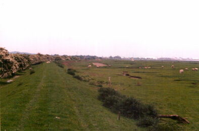 On the Humber floodplain. Broomfleet----->Brough |
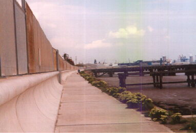
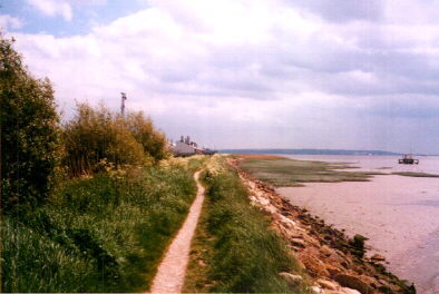 Behind BAe, Brough-----> North Ferriby |
After arriving at Brough, the next part of the route took me behind British Aerospace, where they build the Hawk trainer. The path had now changed to compacted chalk, which was much easier to ride on. After passing a couple of bird watchers who were using a camera with an extremely large telephoto lens, I wondered why more people didn't use this route, considering the alternatives. It was really satisfying to know that I could cycle right to the other side of the city with absolutely no hills and no busy roads. In effect, the Humber had acted as a "liquid hill remover". The point I was cycling at had the Lincolnshire Wolds on my right and the Yorkshire Wolds on the left. I would soon be in North Ferriby and then the rest of the way is easy. Just then the chalk path ended as I rode into a small wood.
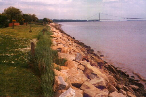
 The path ends and you have to use the foreshore. |
 You are not allowed to walk on the grass. It is at the end of the resident's gardens. You have to carry the bike across all those rocks for a mile when the tide is in! |
The only way to continue the journey was to walk along the foreshore. Unfortunately, the tide was in and soon it was impossible to walk on the sandy ground. I clambered up the rocks to try and find a better way and soon found some perfectly manicured grass lawns to ride on. I was out of luck though. These were the ends of people's gardens and it was plainly stated that they didn't want any walkers trampling over their land.
The only alternative was to carry the bike over these giant boulders for a mile, or turn back. I'd gone too far to give up, so I decided to continue, which took nearly an hour. I couldn't afford to slip and injure myself out here. Eventually I arrived in North Ferriby and reached a much better cycle track. Riding towards Hessle and the north end of the Humber Bridge was now a pleasure as the track was wide enough for a car to use and the surface was quite smooth.
After passing under the Humber Bridge, it was onto normal roads for a couple of miles until another river side path was reached at the western boundary of the city. At this point, one of the alternative routes so far avoided came into view, parallel to the path.
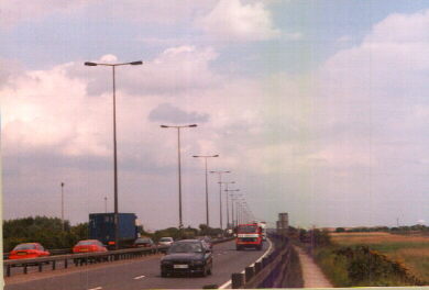 This is the main road into the city. The path on the right is a more pleasant alternative. |
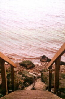
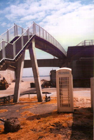 Carrying your bike up these steps over the dock sheds is a bit easier than those rocks. |
After cycling through the western dock area and carrying the bike up the stairs over the dock sheds I was at the city centre in the Marina area. After crossing the River Hull, I continued riding along the River Humber, next to a new village, reclaimed
from the old Victoria Dock. The path was now concrete and so easy to ride on. Some of the houses had verandas that gave great views over the river.
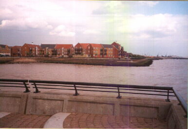 The old Victoria Dock basin is now home to a new smart housing village. |
 Heading east towards Queen Elizabeth Dock. Do not use this path as a short cut after visiting the pub at night! |
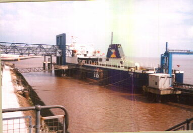
It was time now to cross the lock gates at Queen Elizabeth Dock, always a bit disconcerting. The muddy dock water on the left and the spinning eddies of the Humber on the right. After another two miles I could go no further, the public right of way came to an end at a very remote spot called Lord's Clough on the Old Fleet Drain. No one would ever walk here, you would have to trudge 3 miles to this spot and then back again. One the way back I lost out to the salvage ship "British Shield" and the lock gates opened, stranding me in limbo for 30 minutes. Now it was case of getting home before the thunderstorm brewing in the distance struck.
I was pleased that the trip was completed successfully, although now I've got three choices; 300 feet hills, a very busy road or carrying the bike over giant rocks. Maybe it's time to look for a fourth way.
 The narrow chalk path on the left requires total concentration, otherwise you end up in the water. |
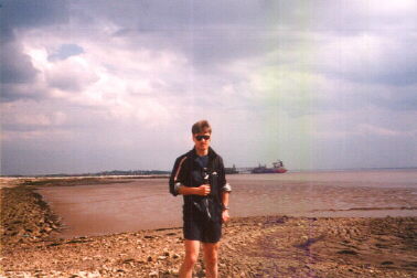 This is as far as you can get. Coincidentally the place in the background is where I work. |